 Thursday August 18:
We left Deb's around 9 AM - she suggested
that would be late enough to avoid traffic issues and she was right.
It slowed down a bit in a couple of places but there were no
major problems. We stopped in Chesapeake, VA for lunch - we
had
no particular destination and actually probably got off at the "wrong"
exit. But we headed down what looked like a
significant
road and serendipitously ended up at the Broken
Egg Bistro.
It was amazingly good, very quick service, great food and
reasonable prices! I had the quiche of the day (spinach,
chicken
and cheese) and John had a red reuben. Recommend it highly! Thursday August 18:
We left Deb's around 9 AM - she suggested
that would be late enough to avoid traffic issues and she was right.
It slowed down a bit in a couple of places but there were no
major problems. We stopped in Chesapeake, VA for lunch - we
had
no particular destination and actually probably got off at the "wrong"
exit. But we headed down what looked like a
significant
road and serendipitously ended up at the Broken
Egg Bistro.
It was amazingly good, very quick service, great food and
reasonable prices! I had the quiche of the day (spinach,
chicken
and cheese) and John had a red reuben. Recommend it highly!
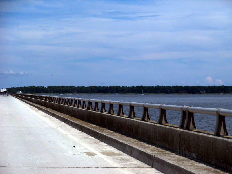
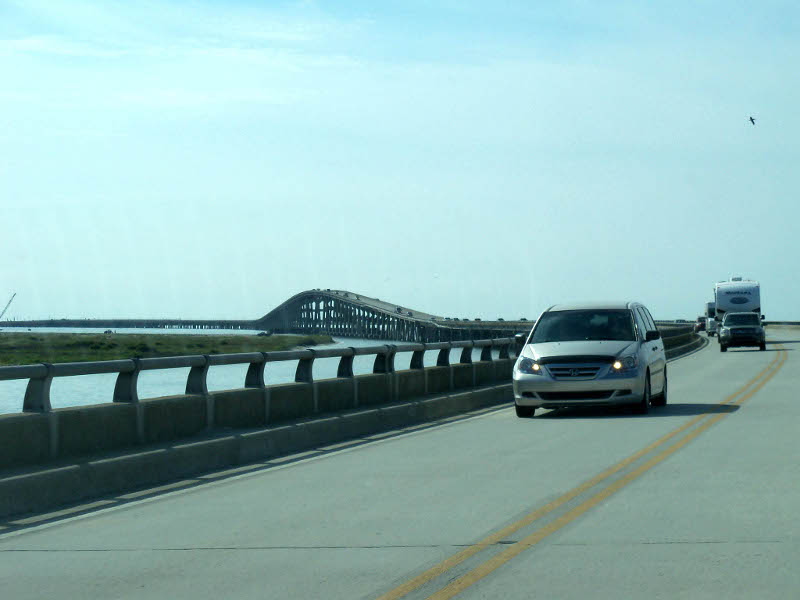
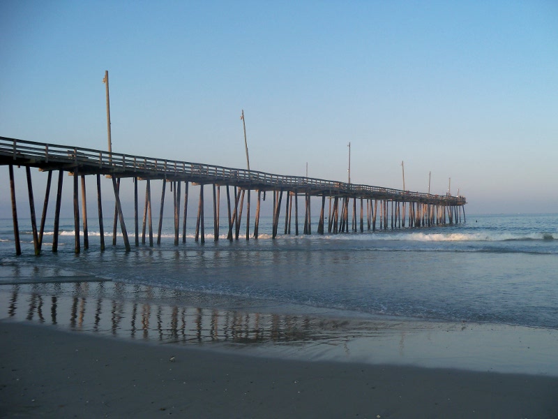
There is a fire still smoldering at the Great Dismal Swamp and today the wind was evidently blowing north and east because we drove through lots of smoke. In fact, our "check engine" light came on but went back off the next day and never came back so we are guessing it was related to the heavy smoke. The picture to the right is crossing the Wright Memorial Bridge from the mainland to the Outer Banks. 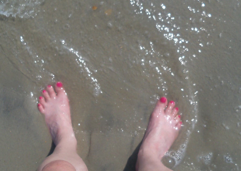 We
arrived at the Oregon Inlet campground around
3:30 PM. The
place
was nearly empty. We knew that the lack of hot water would
deter
some campers but it's so cheap (only $10/ night with an America the
Beautiful pass) and right on the ocean - see Barb's toes at left,
meeting the ocean - that I
couldn't quite believe we
had such a choice of campsites! Apparently
this is
because it was mid-week; it really filled up Friday night and Saturday. We
arrived at the Oregon Inlet campground around
3:30 PM. The
place
was nearly empty. We knew that the lack of hot water would
deter
some campers but it's so cheap (only $10/ night with an America the
Beautiful pass) and right on the ocean - see Barb's toes at left,
meeting the ocean - that I
couldn't quite believe we
had such a choice of campsites! Apparently
this is
because it was mid-week; it really filled up Friday night and Saturday.
 The
downsides of this place were the mosquitos and the
prickly
plants. We had been warned about the mosquitos and so we had
repellent (and itch stick) but have never experienced so many of them
right by the shore! Typically the breezes (I guess) deter
them but not these guys! And the campground
is full of cacti
and
sand burrs, which made it a little tricky to even walk about the site. The
downsides of this place were the mosquitos and the
prickly
plants. We had been warned about the mosquitos and so we had
repellent (and itch stick) but have never experienced so many of them
right by the shore! Typically the breezes (I guess) deter
them but not these guys! And the campground
is full of cacti
and
sand burrs, which made it a little tricky to even walk about the site.
 We
spent some time clearing off an area around the picnic
table
and a place to pitch the tent and never tried to
walk anywhere
without
shoes! We
spent some time clearing off an area around the picnic
table
and a place to pitch the tent and never tried to
walk anywhere
without
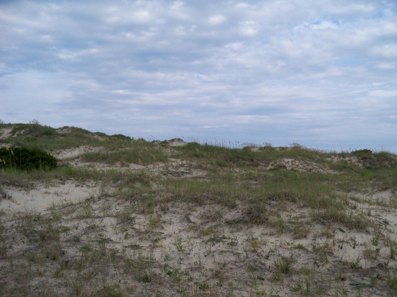
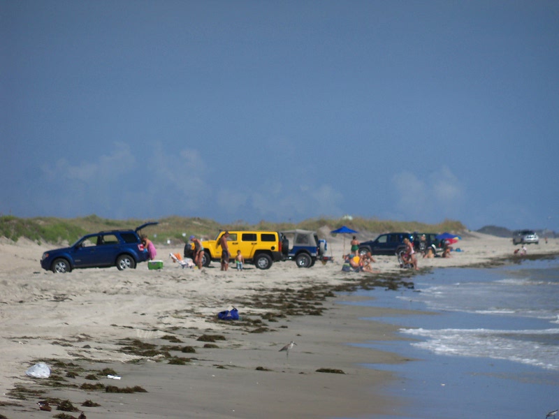
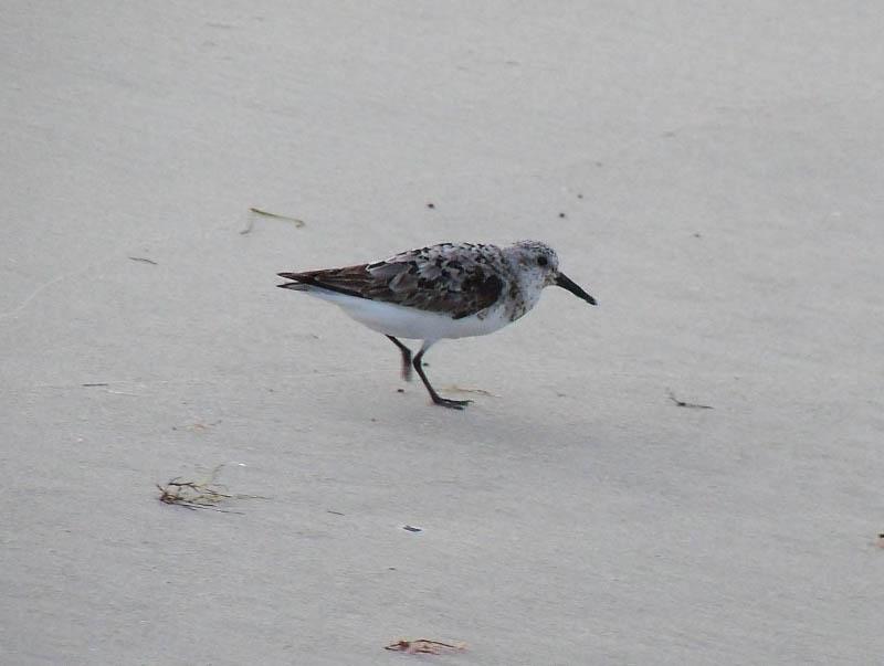
shoes!We set up camp and went to "walk the beach" which is how we spend a lot of time when we're at the shore. Scaling the dunes (at right above) was a little strenuous but good for us! We were surprised at the number of SUV's and pickups down on the beach. It would not have occurred to me that was even allowed, but apparently it is. They line up with the backs open to the water and tailgate! Below are some of our favorite shore birds: a group of willets (unusual - they are typically pretty solitary), a great black backed gull (the largest gull in the world) and a sanderling. 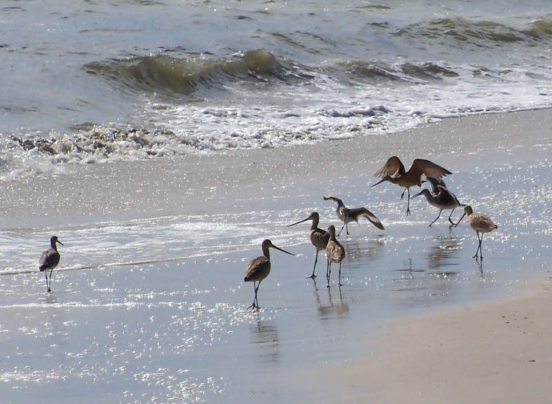 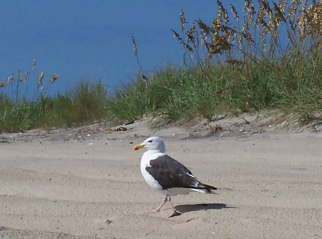
 After we cleaned up, we went to South Beach Grill for dinner. The prices were moderate for the location, and the food was great! We had some coconut shrimp for an appetizer, then I had South Beach veggie pasta and John had fish (mahi mahi) tacos. Back at camp, there were so many hungry mosquitos we just climbed into the tent, and, after killing about a dozen that snuck in with us, we went to bed early. I got up and went to the rest room before midnight and it was beautiful out - the sky was full of stars. But later on the storms rolled in! Our tent, a Kelty dome tent, really proved its worth. 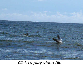 It
was a horrendous thunderstorm and the rain fly on the tent was soaking
but we were not wet inside AT ALL. I even had a
book in
there
with
us, lying on the floor, that didn’t get wet. The ranger came
around in the
morning to
make sure everyone was okay and she was pretty surprised that we
weren't soaked. Our (cheap) shade canopy did not fare as
well,
however. I knew it wasn’t designed for windy
conditions but
it's such a pain to put up that I left it anyway. It
was staked
well enough that it didn't blow away but two of the support
bars
on the
windy side bent quite a bit. It
was a horrendous thunderstorm and the rain fly on the tent was soaking
but we were not wet inside AT ALL. I even had a
book in
there
with
us, lying on the floor, that didn’t get wet. The ranger came
around in the
morning to
make sure everyone was okay and she was pretty surprised that we
weren't soaked. Our (cheap) shade canopy did not fare as
well,
however. I knew it wasn’t designed for windy
conditions but
it's such a pain to put up that I left it anyway. It
was staked
well enough that it didn't blow away but two of the support
bars
on the
windy side bent quite a bit. 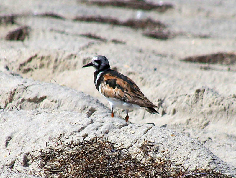 Back
at home John cobbled
together
a
brace and it is still usable though it sags some on that
side. Back
at home John cobbled
together
a
brace and it is still usable though it sags some on that
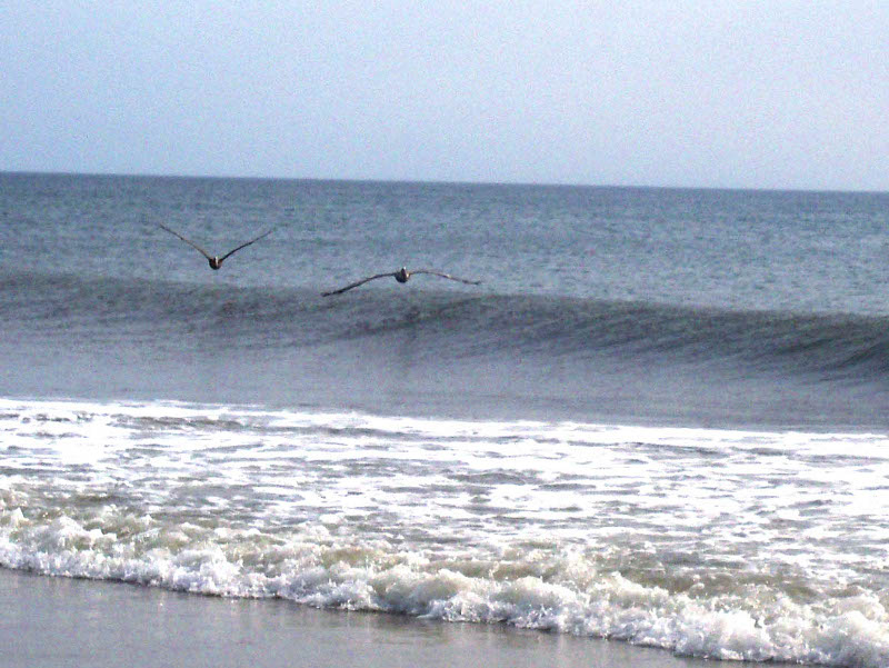
side. Friday August 19: We had been awake much of the night during the thunder and lightning so we didn't get up until 8 AM. After breakfast we went down to the beach again, watched the pelicans dive (above, left - to watch them in action click the image) and the sandpipers running about (to the right is a ruddy turnstone). John also found a Moon jelly (which I identified later at the lighthouse display) but I failed to take its picture. 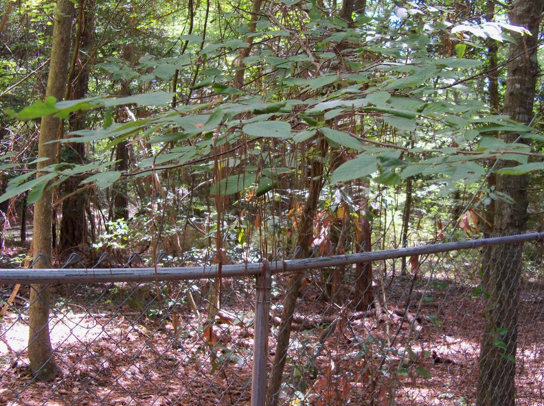 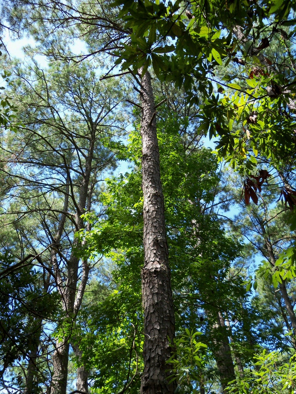 After
a beachy morning, we packed
lunches and went to Nags Head Woods
(owned by the Nature Conservancy)
about noon. We started with the Discovery and Roanoke trails (about 2
miles
round trip). The trails took us by an old Tillitt family
cemetery
where we noticed odd "hangings" from some of the plants (on the left).
Further investigation showed that these were long pine
needles.
Besides those caught on bushes, the trail was covered with
them
which we found very puzzling because we couldn't find any pine trees.
Finally we looked UP instead of "around" and
discovered that
these were very tall pine trees (picture to the right) that had no
branches or needles anywhere near ground level! The trail
continued out of the woods through a marshy area (left below) and ended
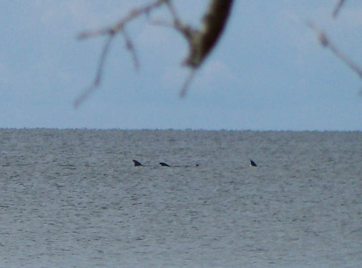
at Roanoke Sound (below, center) where we stopped for lunch on some
convenient benches. We were
pleased to be entertained by the dolphins frolicking in the sound
(below, right)! After
a beachy morning, we packed
lunches and went to Nags Head Woods
(owned by the Nature Conservancy)
about noon. We started with the Discovery and Roanoke trails (about 2
miles
round trip). The trails took us by an old Tillitt family
cemetery
where we noticed odd "hangings" from some of the plants (on the left).
Further investigation showed that these were long pine
needles.
Besides those caught on bushes, the trail was covered with
them
which we found very puzzling because we couldn't find any pine trees.
Finally we looked UP instead of "around" and
discovered that
these were very tall pine trees (picture to the right) that had no
branches or needles anywhere near ground level! The trail
continued out of the woods through a marshy area (left below) and ended
at Roanoke Sound (below, center) where we stopped for lunch on some
convenient benches. We were
pleased to be entertained by the dolphins frolicking in the sound
(below, right)!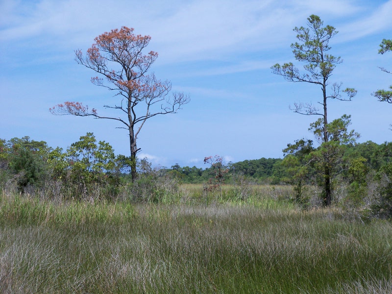 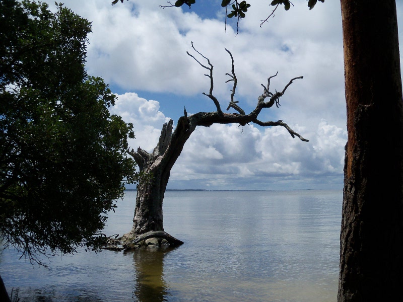
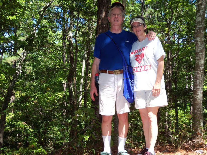 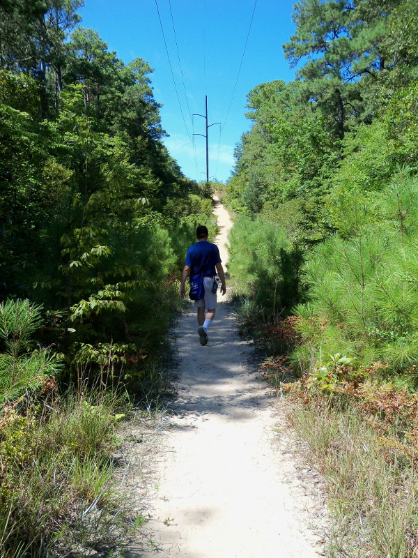 After
lunch
we hiked back, past the old Tillitt home site, to the parking
area, then took
the Center
and Sweetgum trails in the other direction (roughly 2.25 miles total).
The Sweetgum
trail was more strenuous - it's hard to see from the picture at right,
but this sandy part of the trail is at a VERY steep angle!
When
we
got
back to the car about 3 PM, we were soaked -
from humidity,
not rain - and decided that an ice cream stop was warranted!
Logan’s Ice Cream Cottage did not disappoint us.
Two GIANT
scoops, which is about a pint of superb ice cream, was $4 and
definitely worth it. After
lunch
we hiked back, past the old Tillitt home site, to the parking
area, then took
the Center
and Sweetgum trails in the other direction (roughly 2.25 miles total).
The Sweetgum
trail was more strenuous - it's hard to see from the picture at right,
but this sandy part of the trail is at a VERY steep angle!
When
we
got
back to the car about 3 PM, we were soaked -
from humidity,
not rain - and decided that an ice cream stop was warranted!
Logan’s Ice Cream Cottage did not disappoint us.
Two GIANT
scoops, which is about a pint of superb ice cream, was $4 and
definitely worth it.
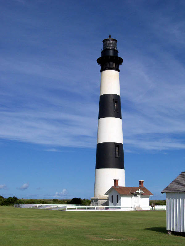 Before going back to camp, we took a
slight detour across the street from the campground to
the Bodie Island lighthouse.
I browsed the
interesting exhibits about
the process of restoring the lighthouse. The external scaffolding is
down now but they are still working
on the inside so it was not open for climbing. Before going back to camp, we took a
slight detour across the street from the campground to
the Bodie Island lighthouse.
I browsed the
interesting exhibits about
the process of restoring the lighthouse. The external scaffolding is
down now but they are still working
on the inside so it was not open for climbing. 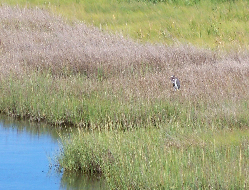 John
didn't want to look at the exhibits, but
he did walk out to the
observation gazebo with me where we saw lots of great
egrets and some tricolored herons (you can't tell until you
enlarge it but that's the bird in the picture to the right).
Then
we went
back to camp to rest a little and change clothes for supper. John
didn't want to look at the exhibits, but
he did walk out to the
observation gazebo with me where we saw lots of great
egrets and some tricolored herons (you can't tell until you
enlarge it but that's the bird in the picture to the right).
Then
we went
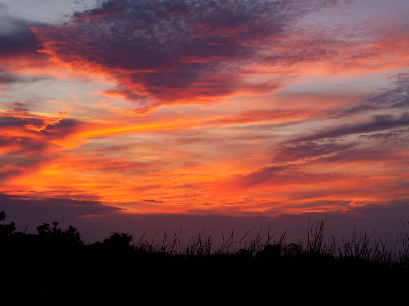
back to camp to rest a little and change clothes for supper.We had planned to go to the Weeping Radish in Manteo for dinner. This brew pub was recommended highly but we discovered it had moved up to Hwy 168/158 in Grandy, NC on the mainland. We actually passed it on our way down to OBX and thought perhaps they had two locations. Darrell’s Seafood was next door to the vacant building so we went with Plan B and it was just fine. The food was great, service excellent and cost was fairly reasonable. Then we just walked around Manteo a little bit – at the marina (left below), we watched a group of young kids having their first experience crabbing. They were SO excited about finding crabs on their lines, it was such fun to see! We were camping on the east (ocean) side so before going back, we stopped across the street at the Oregon Inlet Fishing Center, on the west (sound) side, for the one and only sunset picture of the trip! 
  It
was still buggy back at camp, so we went to bed shortly after the
sunset. The campground began to fill
up on Friday night and they were streaming in Saturday morning –
apparently a lot of weekenders. It
was still buggy back at camp, so we went to bed shortly after the
sunset. The campground began to fill
up on Friday night and they were streaming in Saturday morning –
apparently a lot of weekenders. Saturday August 20: After breakfast, we wiped down the tent (it was still cloudy so it didn’t dry much on its own), packed up and drove across the Herbert C. Bonner Bridge over the Oregon Inlet (the bridge apparently survived Hurricane Irene and the inlet was dredged and enlarged by the storm) to meet good friends Krystal and Nathan at Pea Island Wildlife Refuge - where we got eaten alive.  It sounded
like a nice place for wildlife viewing and a walk around the area, but
the reality was a bit different! They have a fairly nice, but
small, visitor center including some
telescopes for public use. We walked out along the North Wildlife
Trail; saw a group of turtles - it was evident from
their
behavior that many visitors must ignore the "do not feed" sign - a
couple of
great egrets and a swan, but more mosquitos than anything else and we
were being eaten in spite of the repellent, so we
didn’t linger. Below on the right is a view of the bridge and
the
Bodie Island Lighthouse from the wildlife refuge. It sounded
like a nice place for wildlife viewing and a walk around the area, but
the reality was a bit different! They have a fairly nice, but
small, visitor center including some
telescopes for public use. We walked out along the North Wildlife
Trail; saw a group of turtles - it was evident from
their
behavior that many visitors must ignore the "do not feed" sign - a
couple of
great egrets and a swan, but more mosquitos than anything else and we
were being eaten in spite of the repellent, so we
didn’t linger. Below on the right is a view of the bridge and
the
Bodie Island Lighthouse from the wildlife refuge.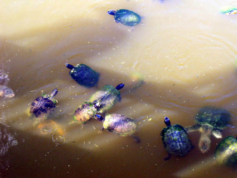 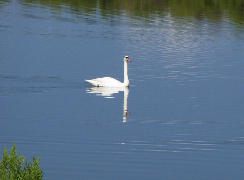 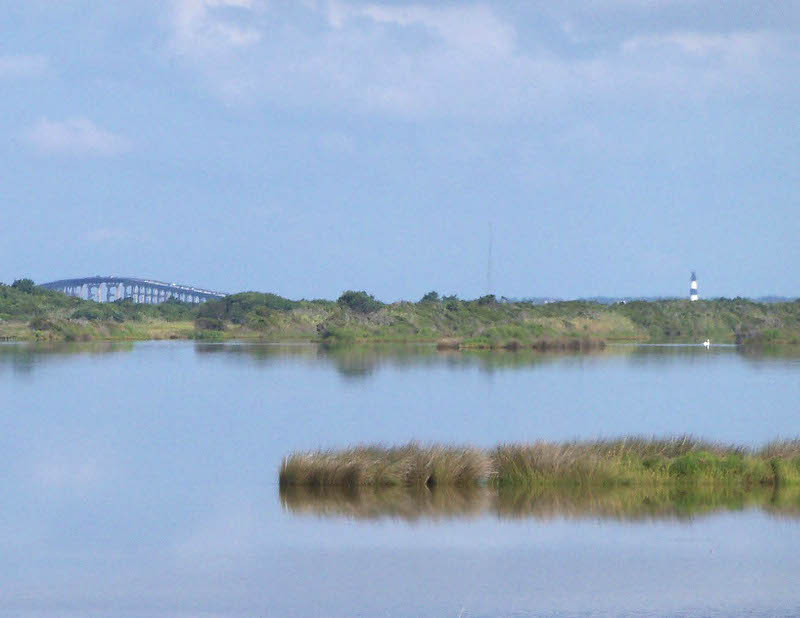  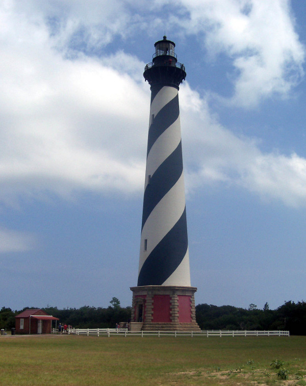 We had lunch at the Atlantic
Coast Cafe in Waves – they had sandwiches, salads and wraps
that
were good and very reasonably priced. We then all
piled into Krystal and Nathan's truck and went down to the Cape Hatteras
lighthouse.
We climbed to the top (248 steps) and took pictures of the
nice
view
(and of each other to commemorate our efforts getting up there).
It was not
crowded at all - the ranger said there were often fewer people on We had lunch at the Atlantic
Coast Cafe in Waves – they had sandwiches, salads and wraps
that
were good and very reasonably priced. We then all
piled into Krystal and Nathan's truck and went down to the Cape Hatteras
lighthouse.
We climbed to the top (248 steps) and took pictures of the
nice
view
(and of each other to commemorate our efforts getting up there).
It was not
crowded at all - the ranger said there were often fewer people on 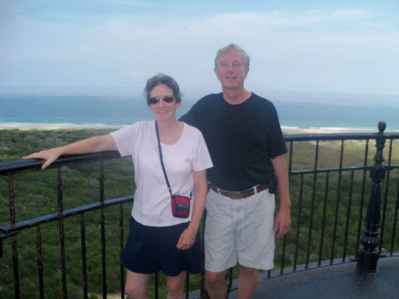 Saturdays
and especially this late in the season. There was a
landing with a window and thus, a photo op, every so often,
providing a
good chance to catch my breath. After the climb, we
went
over to the visitor center where we saw an amazingly good video (about
an hour) all about the 1999 move of the lighthouse to its
current
location. I was not planning on sitting through the whole
thing
but it was quite well done and kept our interest! Saturdays
and especially this late in the season. There was a
landing with a window and thus, a photo op, every so often,
providing a
good chance to catch my breath. After the climb, we
went
over to the visitor center where we saw an amazingly good video (about
an hour) all about the 1999 move of the lighthouse to its
current
location. I was not planning on sitting through the whole
thing
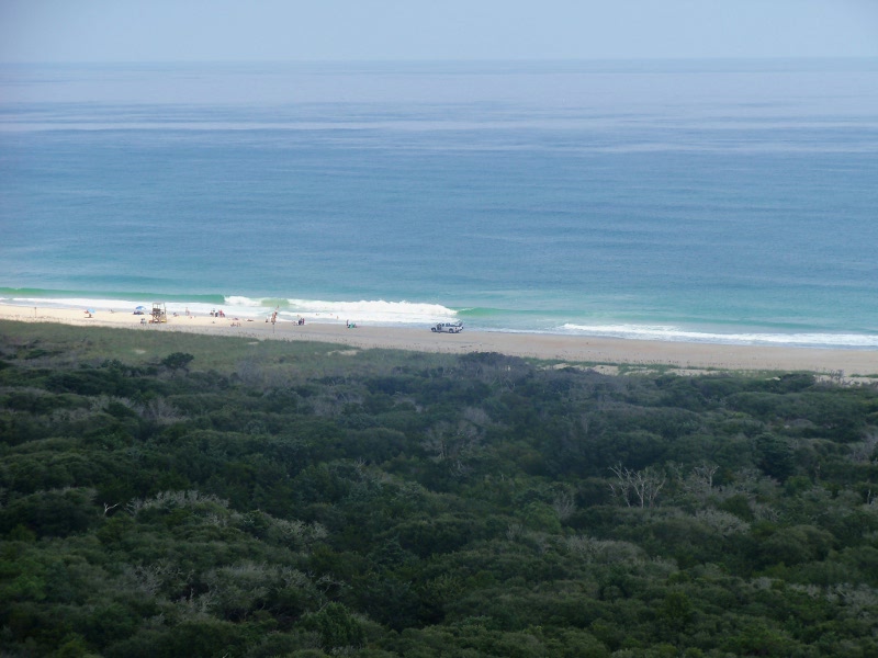
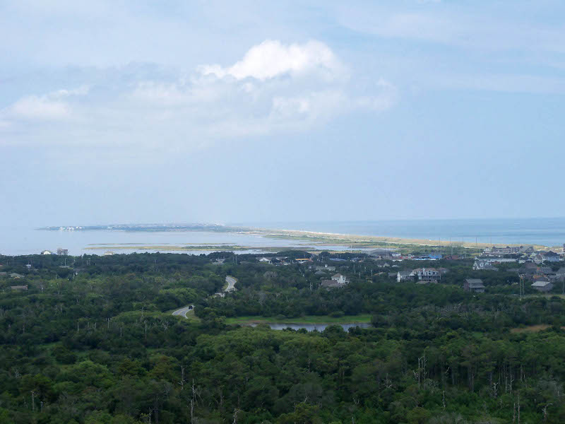
but it was quite well done and kept our interest! The original dedication plaque is on the left below; in the center the ocean view from about half way up and on the right the view to the north from the top. 
   Krystal
and Nathan had very kindly invited us to camp with them for a few days
so we went back to Camp Hatteras (Krystal worked in
the office there), put up the tent, and took a
nice
walk on the beach down to the Rodanthe pier. There were still
a
fair
number of people around but it wasn't at all what I would have called
crowded. Krystal
and Nathan had very kindly invited us to camp with them for a few days
so we went back to Camp Hatteras (Krystal worked in
the office there), put up the tent, and took a
nice
walk on the beach down to the Rodanthe pier. There were still
a
fair
number of people around but it wasn't at all what I would have called
crowded. 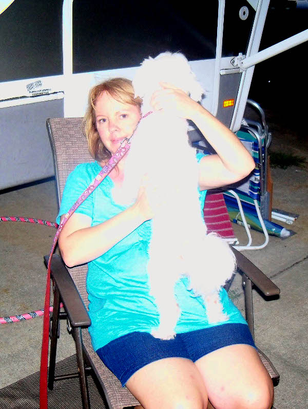 Back
at the campsite, Nathan fixed fajitas for supper and they were very
yummy. He
also made “fake mojitos” with their Vitamix. Back
at the campsite, Nathan fixed fajitas for supper and they were very
yummy. He
also made “fake mojitos” with their Vitamix. 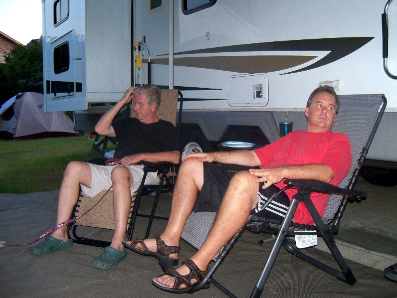 These
are fruit
and
mint smoothies with some spinach added to make it
green.
They were wonderful (no, I didn't taste the spinach at all)!
The next night he whipped up
some
peach smoothies with a little ginger and cinnamon. Oh my - I
think we will need to consider investing in a Vitamix - it's probably
not quite as good unless Nathan comes with it, though! These
are fruit
and
mint smoothies with some spinach added to make it
green.
They were wonderful (no, I didn't taste the spinach at all)!
The next night he whipped up
some
peach smoothies with a little ginger and cinnamon. Oh my - I
think we will need to consider investing in a Vitamix - it's probably
not quite as good unless Nathan comes with it, though!  On the right you can see
our tent
behind the RV. Krystal is shown at left with Ava. I love it
that,
when
she calls the dog, she doesn't yell, she just says calmly and in an
ordinary tone of voice "Ava, would you please come over here now?"
And Ava comes! On the right you can see
our tent
behind the RV. Krystal is shown at left with Ava. I love it
that,
when
she calls the dog, she doesn't yell, she just says calmly and in an
ordinary tone of voice "Ava, would you please come over here now?"
And Ava comes! 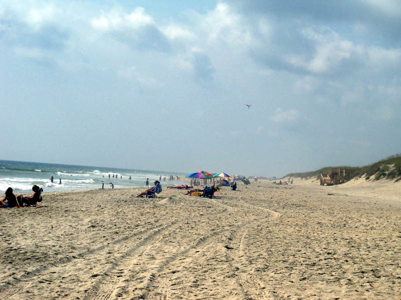 Sunday
August 21: We got up around 8 AM, had HOT showers, and
no mosquitos! Nathan
served us steel cut oatmeal for breakfast - boy, Sunday
August 21: We got up around 8 AM, had HOT showers, and
no mosquitos! Nathan
served us steel cut oatmeal for breakfast - boy,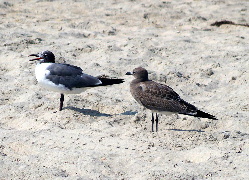 I could get used to
this! Before the rain came, we walked about a mile
and a half to the south on the beach. There were loads of families and
kids just
having fun - and it was fun to watch them! Also plenty of
shore birds: laughing gulls at right.
I could get used to
this! Before the rain came, we walked about a mile
and a half to the south on the beach. There were loads of families and
kids just
having fun - and it was fun to watch them! Also plenty of
shore birds: laughing gulls at right.We went up to Kill Devil Hills for lunch at the Plaza Azteca Mexican restaurant – great food, low prices, very enjoyable. After lunch, I did some laundry and caught up with Krystal while John and Nathan did some errands, including putting air in our tires. Nathan grilled shrimp and we had potato salad and corn on cob for supper. Have I said yet what wonderful friends these are?  We went to bed around 10 PM with
storms
threatening. We went to bed around 10 PM with
storms
threatening. 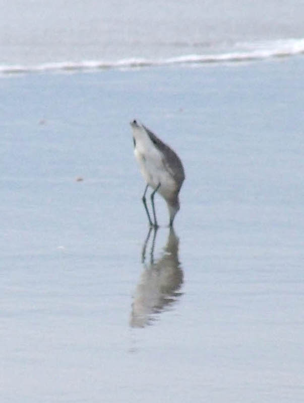 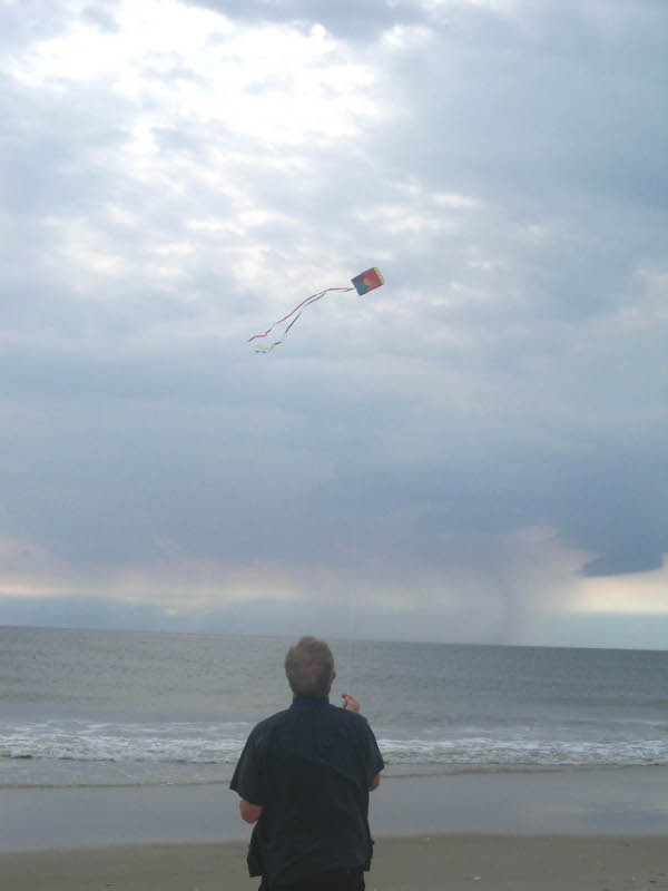 Monday
August 22: I don’t think it rained overnight but when we woke at
7 AM, it was very
windy, dark and ominous – I freaked and started packing up and taking
the tent
down very quickly because I sure didn’t want to do it in the rain!
Turned out that it only rained about 2 minutes.
We went up to the Java Junction coffee shop (part of the
Glass Bead at Moon Over Hatteras) for a nice breakfast (pastries, lots
of different types of tea and coffee) then, since it was still dry but
pleasantly breezy, we stopped
at a Pea Island beach access (below on left), flew a kite for a while
and had the beach to
ourselves - except for the birds (sandpiper at the right and pelicans
below) hunting in their own ways for breakfast.
There were storms not too far from shore which made the sky
quite interesting! Monday
August 22: I don’t think it rained overnight but when we woke at
7 AM, it was very
windy, dark and ominous – I freaked and started packing up and taking
the tent
down very quickly because I sure didn’t want to do it in the rain!
Turned out that it only rained about 2 minutes.
We went up to the Java Junction coffee shop (part of the
Glass Bead at Moon Over Hatteras) for a nice breakfast (pastries, lots
of different types of tea and coffee) then, since it was still dry but
pleasantly breezy, we stopped
at a Pea Island beach access (below on left), flew a kite for a while
and had the beach to
ourselves - except for the birds (sandpiper at the right and pelicans
below) hunting in their own ways for breakfast.
There were storms not too far from shore which made the sky
quite interesting!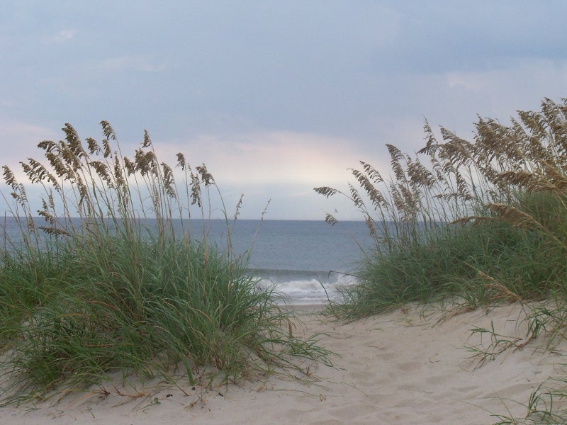
 Our next stop was at the Elizabethan Gardens on Roanoke Island. While this is still technically in the Outer Banks, in the interest of balancing file size a bit, we're moving it to Part 3. It was the beginning of our the trip westward to Black Mountain! Click here
to go on to Black Mountain, NC, Part 3 of our trip.
|